Rytentunga (Lofoten)
Wanderung zu einem berühmten Fotospot am Ryten
by broiler
 Norway > Nord-Norge > Nordland
|
|
||||
|
|||||
| Dangers |

|
| Infrastructure |

|
| Route |


|
| Waypoints |

|
| Time |

|
| Listing |

|
![]() Description
Deutsch
(German)
· English
Description
Deutsch
(German)
· English
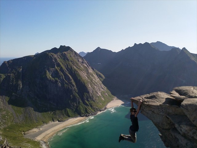
Diese Wanderung führt dich zu einem berühmten Fotospot in der Nähe des Rytengipfels mit Traumblick über die Kvalvika (Strand, der nur über eine Wanderung zu erreichen ist).

Parken:
Entweder hier: N 68 05.436 E 013 09.397 (für 100 NOK, 100 SEK oder 10€ (Stand Sommer 2019)) oder am Torfmuseum N 68 05.318 E 013 08.348 (50 NOK).
Start: N 68° 05.453 E 013° 08.866
Wegstrecke:
einfache Richtung ca. 4km, 540 Höhenmeter bis zum Gipfel, bis zum Fotopunkt ca. 480 Höhenmeter
Der Weg ist gut ausgebaut, verläuft bei Sumpfgebieten über Holzstege und zwei schwierigere Stellen bei ca. 130 Höhenmeter sind mit Seil gesichert.
Deine Aufgabe:
Mache ein nettes Foto von dir und der Rytentunga. Du wirst sehen, das Listingfoto zu schießen ist weit ungefährlicher als es aussieht! Achte totzdem auf deine Sicherheit! Lade das Foto bei deinem Log hoch!
Viel Spaß!
![]() Utilities
Utilities
 Search geocaches nearby:
all -
searchable -
same type

 Download as file:
GPX -
LOC -
KML -
OV2 -
OVL -
TXT -
QR-Code
 When downloading this file, you accept our terms of use and Data license.
![]() Log entries for Rytentunga (Lofoten)
Log entries for Rytentunga (Lofoten)
![]() 0x
0x
![]() 0x
0x
![]() 0x
0x


 Size: no container
 Status: Available
 Time required: 5:00 h
 Route: 8 km
 Hidden on: 12 August 2019
 Listing: https://opencaching.de/OC15A0B
 0 Found
 0 Not found
 0 Notes
 0 Watchers
 0 Ignorers
 27 Page visits
 0 Log pictures
