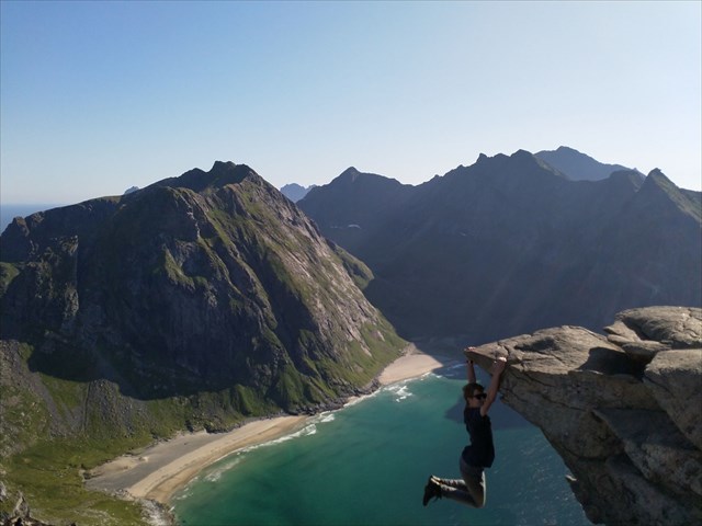
Rytentunga (Lofoten)
Wanderung zu einem berühmten Fotospot am Ryten
di broiler
 Norvegia > Nord-Norge > Nordland
|
|
||||
|
|||||
| Pericoli |

|
| Infrastrutture |

|
| Percorso |


|
| Waypoints |

|
| Tempo |

|
| Listing |

|
![]() Descrizione
Deutsch
(Tedesco)
· English
Descrizione
Deutsch
(Tedesco)
· English
Diese Wanderung führt dich zu einem berühmten Fotospot in der Nähe des Rytengipfels mit Traumblick über die Kvalvika (Strand, der nur über eine Wanderung zu erreichen ist).

Parken:
Entweder hier: N 68 05.436 E 013 09.397 (für 100 NOK, 100 SEK oder 10€ (Stand Sommer 2019)) oder am Torfmuseum N 68 05.318 E 013 08.348 (50 NOK).
Start: N 68° 05.453 E 013° 08.866
Wegstrecke:
einfache Richtung ca. 4km, 540 Höhenmeter bis zum Gipfel, bis zum Fotopunkt ca. 480 Höhenmeter
Der Weg ist gut ausgebaut, verläuft bei Sumpfgebieten über Holzstege und zwei schwierigere Stellen bei ca. 130 Höhenmeter sind mit Seil gesichert.
Deine Aufgabe:
Mache ein nettes Foto von dir und der Rytentunga. Du wirst sehen, das Listingfoto zu schießen ist weit ungefährlicher als es aussieht! Achte totzdem auf deine Sicherheit! Lade das Foto bei deinem Log hoch!
Viel Spaß!
![]() Utilità
Utilità
 Cerca geocache vicine:
tutte -
ricercabile -
stesso tipo

 Scarica come file:
GPX -
LOC -
KML -
OV2 -
OVL -
TXT -
QR-Code
 Scaricando questo file accetti i nostri termini di utilizzo e la Licenza dati.
![]() Log per Rytentunga (Lofoten)
Log per Rytentunga (Lofoten)
![]() 0x
0x
![]() 0x
0x
![]() 0x
0x


 Dimensioni: nessun contenitore
 Stato: disponibile
 Tempo necessario: 5:00 h
 Lunghezza percorso: 8 km
 Nascosta il: 12. agosto 2019
 Listing: https://opencaching.de/OC15A0B
 0 trovata
 0 non trovata
 0 Note
 0 Osservata
 0 Ignorata
 27 Pagina visite
 0 Log immagini
