|
|
||||
|
|||||
| Infrastrutture |

|
| Percorso |

|
| Tempo |


|
| Stagionale |

|
| Necessaria preparazione |

|
![]() Descrizione
Deutsch
· English
(Inglese)
Descrizione
Deutsch
· English
(Inglese)
Horseshoe Crater Bausenberg |
||||||||
|
|
||||||||
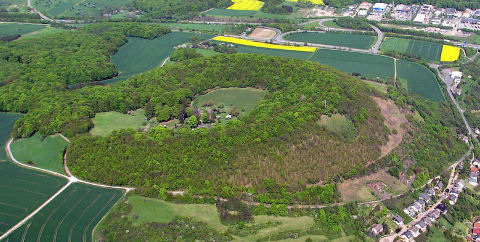
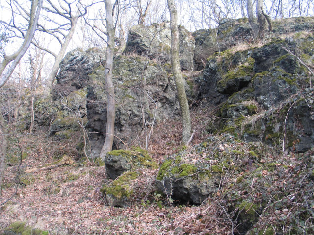
| Strong lava – breached volcano! The short lived activity of the Bausenberg volcano lasted for just a few weeks, during which time a cinder cone was created The lava gushed up inside the volcano, breached the weakest area of the northern section of the rampart and was then ejected as a lava flow. That is how the volcanic formation got its characteristic horseshoe shape. The Bausenberg remains the best preserved horseshoe crater in the Eifel today! A large variety of different kinds of biotope can be found at the crater and its rampart. The Niederzissener Hausberg thus has protected Status and is home to well over 500 spedes of plants and a fauna consisting of more than 5,000 different species. Come on a pleasant walk along the edge of the crater and discover this natural landscape. The coordinates indicate the parking facility. Please follow the sign Route M.  Bausenberg located in a
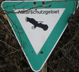
nature reserve. Please stay on the trails. Bausenberg located in a
nature reserve. Please stay on the trails.
|
||||||||
|
Please send the answers with this form. |
||||||||
|
|
||||||||
|
|
![]() Utilità
Utilità
![]() Questa geocache è probabilmente situata all'interno di un'area naturale protetta! Per favore, vedi qui per ulteriori informazioni.
Questa geocache è probabilmente situata all'interno di un'area naturale protetta! Per favore, vedi qui per ulteriori informazioni.
Naturschutzgebiet
Bausenberg (Informazioni)
Questa geocache probabilmente è situata in una riserva naturale (Info): FFH-Gebiet Vulkankuppen am Brohlbachtal (Informazioni), Landschaftsschutzgebiet Rhein-Ahr-Eifel (Informazioni)
 Visualizza le raccomandazioni degli utenti che hanno raccomandato questa geocache: all
 Cerca geocache vicine:
tutte -
ricercabile -
stesso tipo

 Scarica come file:
GPX -
LOC -
KML -
OV2 -
OVL -
TXT -
QR-Code
 Scaricando questo file accetti i nostri termini di utilizzo e la Licenza dati.
![]() Log per Hufeisenkrater Bausenberg
Log per Hufeisenkrater Bausenberg
![]() 19x
19x
![]() 0x
0x
![]() 0x
0x

 22. ottobre 2023, 14:25
Lacuma
ha trovato la geocache
Ein beeidruckender Ort und eine sehr schöne Wanderung.
Ein empfehlenswerter Cache.
Und wieder lächelt uns ein Smilie mehr auf der Karte an. Danke fürs legen und pflegen der Dose. Danke für den Spaß und einen schönen Gruß aus Lankern.
Lacuma
 03. ottobre 2022, 21:06
chloderic
ha trovato la geocache
Heute besuchten MYKCharade , MelanieBri und ich den Cache "Hufeisenkrater Bausenberg".
Schönenen Dank für die informative Runde in tollem Gelände.
Gruß
chloderic
 16. luglio 2021
xtqx1
ha trovato la geocache
Heute ging es auf Erkundungstour rund um und über den Bausenberg.
Da die Fernsicht recht eingeschränkt war, musste sich mit der naheliegenden Geologie beschäftigt werden, es hat sich gelohnt.
Ein wirklich beeindruckender Schlackenkegel, der sich hier erhebt. Stellenweise fühlte man sich fast ein wenig an das Raudholar Gebiet auf Island erinnert.
Unglaublich was sich hier vor (geologisch betrachtet) kurzer Zeit ereignet hat.
Danke fürs Zeigen und aufmerksam machen,
xtqx1
 12. giugno 2021
URilomeo
ha trovato la geocache
Für heute hatte ich zusammen mit omblo und Stefan (003) eine Exkursion durch die östliche Eifel geplant. Hier sollten viele geologische Besonderheiten erkundet werden. Den Tagesabschluß bildete dann der Hufeisenkrater. Das war schon interessant, wie asymmetrisch hier der Kraterwall geformt ist. Natürlich wurden unterwegs auch die gesuchten Antworten mit eingesammelt. Danke für das Herlocken.
Immagini per questo log:URi an der Wallkrone

 07. aprile 2021, 16:19
filser1
ha trovato la geocache
Einmal um den Bellerberg mit Ersteigung des Hufeisenkraters. Eine schöne und lehrreiche Runde. Da sind schon mächtige Exemplare dabei. Imposant. Diese Runde hätte ich ohne den Cache sicher nicht gelaufen.
T4TC Filser1


 Germania > Rheinland-Pfalz > Ahrweiler


 Dimensioni: nessun contenitore
 Stato: disponibile
 Tempo necessario: 1:30 h
 Lunghezza percorso: 2.6 km
 Nascosta il: 05. marzo 2010
 Listing: https://opencaching.de/OC9F14
 Pubblicata anche su:
  19 trovata
 0 non trovata
 0 Note
 1 Osservatore
 1 Ignorata
 344 Pagina visite
 6
6 


