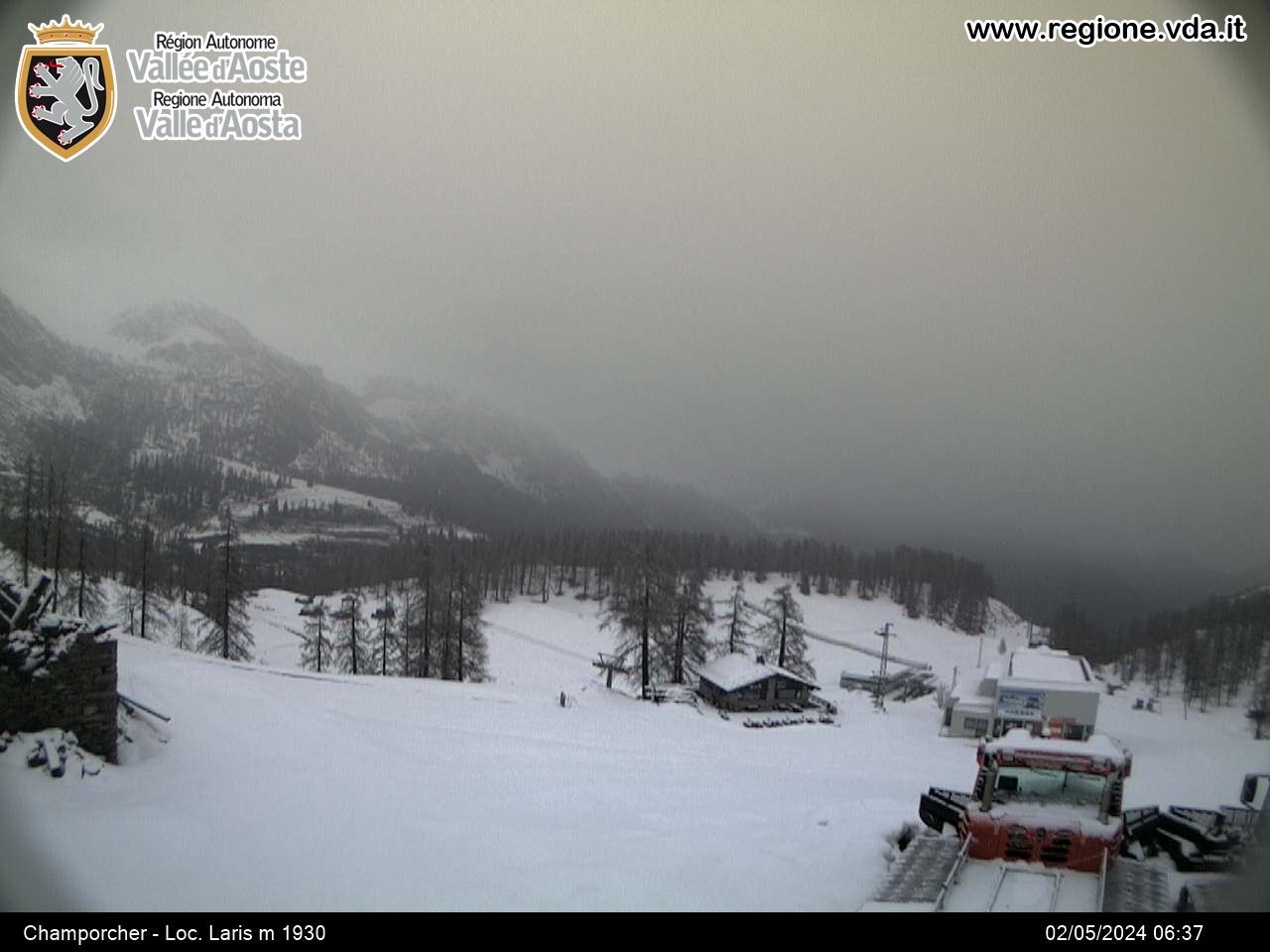
WebCam - Champorcher-Laris
【ツ】 Put Your Hands Up in the Air...
door AlGaAlOz
 Italië > Valle d'Aosta/Vallée d'Aoste > Valle d'Aosta/Vallée d'Aoste
|
|
||||
|
|||||
| Route |

|
| Waypoints |

|
| Time |

|
| Seasonal |


|
| Listing |

|
![]() Beschrijving
Deutsch
· English
(Engels)
Beschrijving
Deutsch
· English
(Engels)
 Go to the coordinates 45.61070°N 7.58731°E
You will be in front of a webcam that takes a picture every 15 minutes.
Now you need someone to save the picture of yourself taken by the webcam
or save it as a screenshot on your smartphone.
Operating time: The webcam is not permanently online outside of the ski season.
To log this cache, you have to post this picture. The picture should allow to identify you.
How you do that is up to you:
holding up an umbrella, banners, warning vests, balloons, headlights, or cheering into the camera...
all the purpose is welcome!
visit: WebCam · Image
![]() Gecodeerde hint
Gecodeerde hint
![]() Decoderen
Decoderen
Vs gur jropnz vf bssyvar, cyrnfr gnxr n cubgb bs lbhefrys be lbhe TCF/fznegcubar, fubjvat gur jropnz va gur onpxtebhaq.
A|B|C|D|E|F|G|H|I|J|K|L|M
N|O|P|Q|R|S|T|U|V|W|X|Y|Z
![]() Afbeeldingen
Afbeeldingen
![]() Hulpmiddelen
Hulpmiddelen
 Zoek caches in de omgeving:
alle -
zoekbaar -
zelfde cache soort

 Download als bestand:
GPX -
LOC -
KML -
OV2 -
OVL -
TXT -
QR-Code
 When downloading this file, you accept our terms of use and Data license.
![]() Logs van WebCam - Champorcher-Laris
Logs van WebCam - Champorcher-Laris
![]() 0x
0x
![]() 0x
0x
![]() 0x
0x


 Grootte: geen behuizing
 Status: Beschikbaar
 Verborgen op: 30. november 2017
 Listing: https://opencaching.de/OC141EF
 0 Gevonden
 0 Niet gevonden
 0 Opmerkingen
 1 Watcher
 0 Negeerders
 15 Bekeken
 0 Log pictures
